For agents and property owners
Aerial and exterior property photography
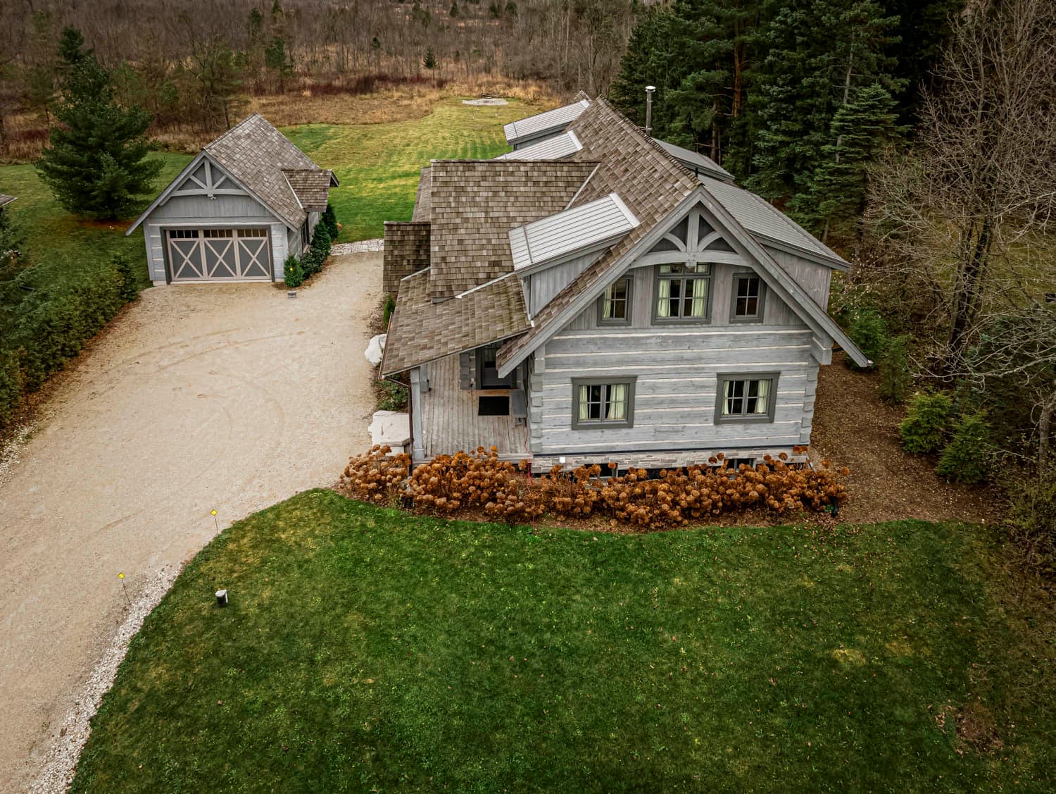
Farms, estates, chalets, acreage and shoreline, flown for the land and finished on the ground — the properties where the setting is most of what is being sold.
Why Pete
Pete Mather photographs property from the air and the ground across South Georgian Bay: the aerial and the exterior stills from one visit with one photographer, so nothing is scheduled twice or colour-matched afterwards. He is accredited by the Professional Photographers of Canada in seven categories, flies on a Transport Canada certificate carrying $1,000,000 in liability insurance, and took drone training built specifically around property work. He works out of Thornbury, inside the market rather than an hour from it.
How it works
One visit, one delivery link.
Three steps, and the airspace question gets answered in the first one rather than on the day.
Send the address
The property, what needs to be in frame, and roughly when the images are needed. The airspace over that specific address gets checked before a date is agreed.
Fly it, then shoot it
The aircraft goes up for the parcel, the frontage and the setting, and the exterior ground stills are made on the same visit rather than on a second one.
One delivery link
Web-sized and print-resolution versions of the same frames, in a single link.
Between booking and the visit, the property itself needs an hour of work outside, and the half of it people miss is what the drone sees: How to get a property ready for photos.
Pete holds a Transport Canada Basic Operations pilot certificate for drone flight, carries $1,000,000 in liability insurance, and completed additional property-focused drone training with AlteX droneHUB.
Scope
What a property shoot covers.
No tiers to choose between. The coverage is scoped to the property itself and quoted before anything is booked.
The aircraft goes up for the things a camera on the ground has never been able to settle: how large the parcel is and where it ends, what backs onto it, how far the water or the road is, how the outbuildings sit against the house, and the way the land itself falls. The same visit produces exterior stills of the buildings, made at the hour the light is actually on them. That is one booking and one set, not two.
A property whose selling point is a hundred acres and a property whose selling point is a view down to the bay want different flights, so the shoot is sized to the address rather than picked off a list. What moves the number, and what to send to get one, is on the pricing page.
The work
Property, shown as a property.
Aerial context and exterior detail, shot with the same eye Pete brings to his fine art work.
Questions
What agents and owners ask first.
The seven that come up on the phone before a property shoot gets booked, answered here so they do not have to be asked.
- How far ahead should a property shoot be booked?
- Further ahead than the day you need the photographs, because the visit is scheduled around the light rather than around the calendar. The hour before sunset is the one that makes an exterior work, and on this side of Georgian Bay it is also the hour a forecast can take back. Send the address and the day the images are needed, and the visit gets set from there.
- What does this cover?
- The property from the air and from outside it: the parcel and where it actually ends, the frontage, the outbuildings, the treeline, the water or the hill behind it, and exterior stills of the buildings made on the same visit as the flight. It is coverage built for properties where the land is a large part of what is being sold — farms, estates, chalets, acreage and shoreline — rather than for the inside of a house.
- What happens if the weather turns on the shoot day?
- The flight is the half the weather decides. Rain and the wind that comes off the bay in the afternoon both ground a drone, so a booked flight moves rather than gets flown badly. Exterior ground work can often still go ahead. Which of those happens is a call made that morning against the forecast, not a conversation after the gallery arrives.
- Who can use the photos, and where?
- That is settled in the quote, before the shoot. Say at booking where the images will end up, and that use is written into what you book. A set made for one listing and a set made for a season of a team's marketing are not the same job and are not priced the same way, but nothing gets held back once the files land.
- What comes back, and in what sizes?
- One delivery link holding web-sized files and print-resolution versions of the same frames for anything that goes on paper. A finished set is easier to judge than to describe: the aerial and property frames in the portfolio were shot with the same eye and the same equipment as a property set.
- Are you insured, and can the brokerage see proof?
- Yes. Pete flies on a Transport Canada Basic Operations pilot certificate and carries $1,000,000 in liability insurance, and both go to a brokerage or a property owner who asks for them. The drone training behind that was real estate-specific, through AlteX droneHUB. The photography behind it is 35 years and seven PPOC accreditations, which is the page about Pete Mather rather than this one.
- What if the property is outside Collingwood and Thornbury?
- Meaford to Wasaga Beach along the bay, and inland to Creemore, is the regular run, and anything inside it books as normal — each of the towns Pete covers has a page on what gets photographed there and why the air is the way to do it. Past that edge, including the far end of Simcoe County, the job still gets quoted, with the travel inside the number rather than added to the invoice afterwards.
By market
The same aerial argument, made differently in each town.
What a property needs shown from the air changes with the address. Collingwood property photography is a competition problem: one aerial frame is often the only thing separating a gallery from the dozen it is being compared against in the same afternoon. On a Wasaga Beach property it is a proximity problem, and one shoreline frame settles it. Property up in The Blue Mountains sells on elevation, sightlines and what stands between a chalet and the bay.
Around the harbour end of the township, Thornbury property photography covers village lots, orchard acreage and waterfront, and village and riverside property in Clarksburg trades on the street and the river as much as on the building. Further out, farms and rural acreage around Meaford and century-village and concession properties near Creemore are cases where the parcel is the larger half of what is being sold.
Two questions come up on every one of them, whatever the address: what a drone is allowed to do over the property, and what to do with the place the evening before. Both are answered at length in the photography guides for sellers and agents.
Keep reading
Before you book a property shoot.

Property to photograph?
Send the address and roughly when the images are needed. Pete will check the airspace over it and come back with what the visit can cover.